Get data from Koordinates into Google Earth
This is an introductory guide explains how to get data from Koordinates into Google Earth, an application that enables users to easily navigate satellite imagery. It is relatively easy for users - even those with limited GIS knowledge or experience - to layer data from Koordinates in Google Earth.
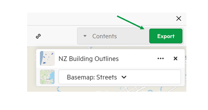
1. Find your data
Enter a search-term to find your dataset of choice. Click Add to have the data added to the map.
2. Select Export to download your data
In the export window, select KML as the download type, which is simply the file type that works with Google Earth.
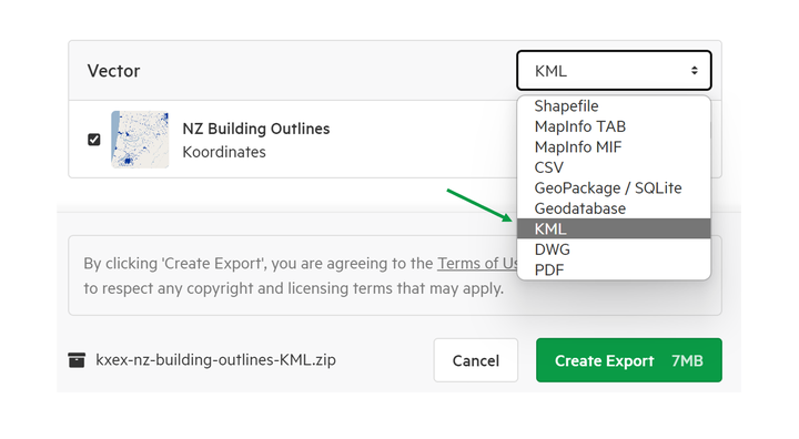
Once you’ve accepted the terms, Koordinates will process your download request. After the download has been processed, you’ll get an email, with a link to download a .zip file of your chosen dataset.
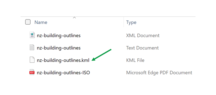
Click on this link and your download will begin.
3. Find the .kml file
After the download is complete, you will need to find the file in your download folder. Unzip the recently downloaded folder, and select the KML file.
4. Get your data into Google Earth
If you have downloaded Google Earth, all you have to do now is click that ‘.kml’ link and Google Earth will pop up. You’ll see a representation of Earth, which will spin around and then zoom into the location of your dataset.
Now, you will be able to zoom into the extent of your chosen dataset and see your data layered over Google Earth.