Learn more about a dataset
While searching for data on Koordinates, you are able to learn more about individual datasets before adding them to the map.
Datasets on Koordinates sites come with a range of supporting information explaining the nature and history of the dataset and how it can be used.
Data Cards - Summary
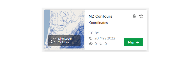
The first interaction with any dataset on a Koordinates site will usually be the summary view provided on the left hand side of the screen. This view provides a concise introduction to the basic features of the dataset. These are:
- The title of the dataset
- The source of the dataset
- Date added and updated
- View and download count
- A '+' button to add the dataset to your map.
More about your dataset
Data Sheets - Info
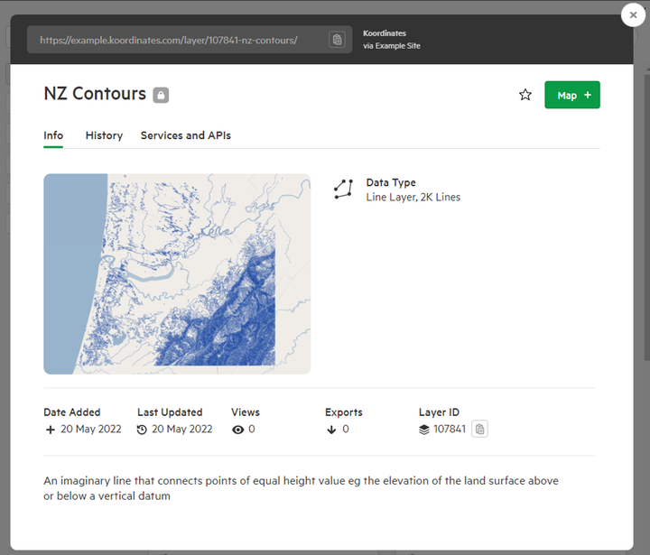
If you click on either the title or thumbnail of your chosen dataset, you’ll be taken to the dataset’s Info page, indicated by the tab under the title. This page gives a range of additional information about the dataset. Depending on the dataset you are viewing, the Info page will provide:
- A general introduction to the dataset, which may include a statement about the dataset’s accuracy.
- A thumbnail of your dataset and its type.
- The dataset's metadata
- The dataset’s licence.
- Information about how the dataset has been categorised and tagged.
- Technical details about the dataset, including its feature count, primary key and attributes.
- Source code to embed the dataset.
Below the initial information, you will also find metadata controls and further details. The metadata section displays the metadata available for your chosen dataset. If the metadata is available in more than one standard, a dropdown menu on the right lets you choose which standard you want to see. From here, you are able to download the metadata for your dataset in XML and/or PDF formats.
History
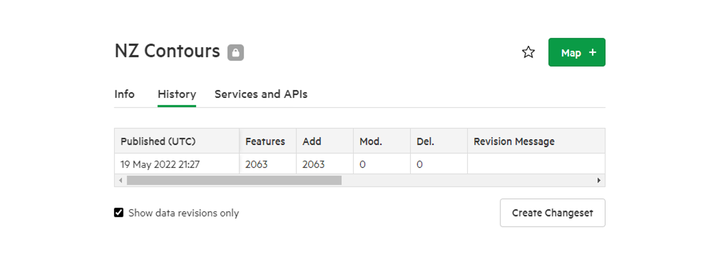
Selecting the History tab under the title of the dataset, you will be able to view its history. Information contained in this section includes when it was first uploaded, its latest changes and its revision history. You can use the check-box to limit the view to show only the revisions of the dataset.
Note that the revision history of the dataset is an automated technical history of the dataset generated by Koordinates, so users can understand how up-to-date the data might be.
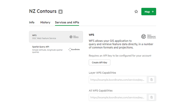
Services and APIs
If enabled for your chosen dataset, the Services tab will list APIs and web services available for each dataset. WFS and Spatial Query APIs are commonly presented in this section. Selecting 'Create API Key' will lead you to generate a new key for use with your dataset.