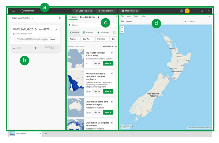
The layout of the Koordinates app
This guide relates to Koordinates Desktop App.
For the Data Portal v10 and koordinates.com refer to The Koordinates Portal Layout
The Koordinates Desktop App tool that allows you to easily find, manage and view data, from a growing number of providers across the globe.
The Koordinates portal is made up of 4 sections:
a) Top Navigation
b) Local Repository Browser
c) Data Browser / Manage Data
d) Map Viewer / Table Viewer
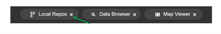
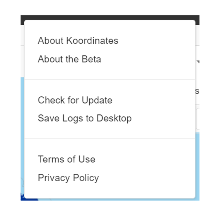
Top Navigation

From the Top Navigation, users can
a) access the File, Edit View and Window menus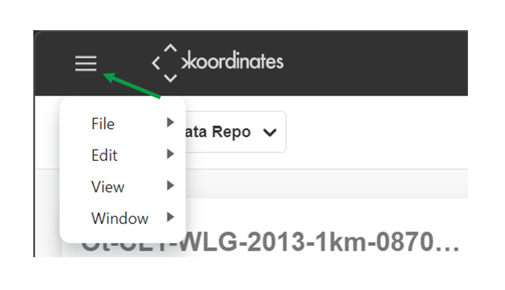
b) toggle on or off the app panels
c) access Koordinates Help documentation, Privacy Policy & Terms of Use

d) access Koordinates ID profile.

More information:
Local Repository Browser
The Local Repository Browser panel connects Koordinates App to local data repositories.
These can be viewed, updated, and pushed to the Koordinates Cloud.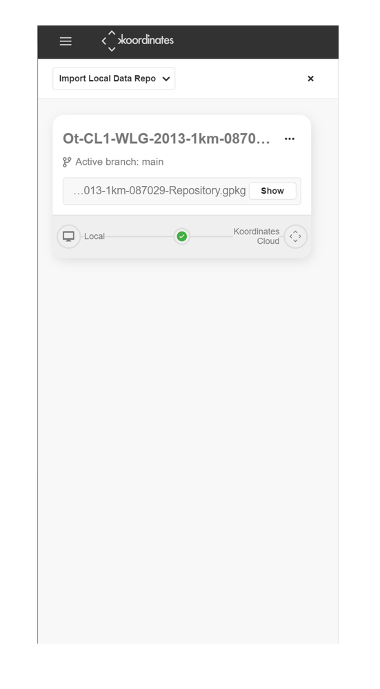
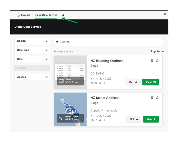
Data Browser
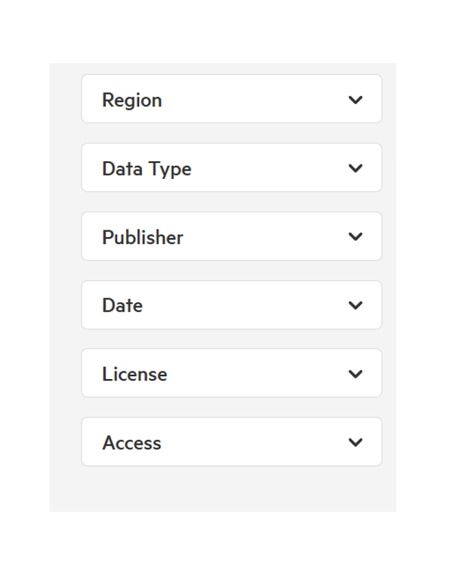
From the Data Browser, users can search, filter and sort for data.
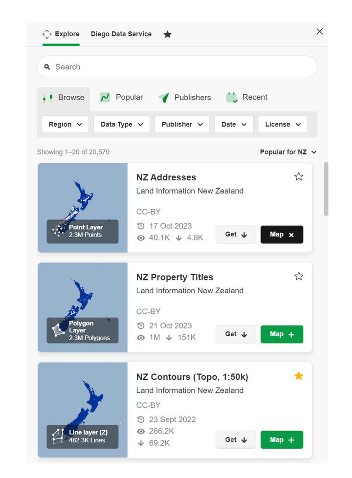
These results can be further filtered by Type, Date & License, Region. Additional filters are available for Enterprise users, including Group, Category & Access.
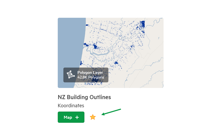
Map Cards display key information about the data results, and allow interacting with the data, including adding it to the Map Viewer, or assign as a Favourite.
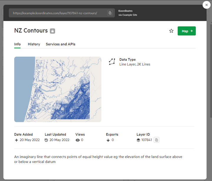
Dataset Sheet
Selecting a dataset will open its Sheet, providing more information, including:
- Data Type
- Metadata
- Tags
- Details
- History, &
- Data Sample
More Information:
Organisation & My Data (Paid Seta & Pro Users)
For paid seats and pro users, all 'owned' data associated with the user account can be found and used from the Organisation or My Data tab.
Favourite
From the Favourite pane, datasets that have been Starred will appear. This is useful for frequently accessed datasets.
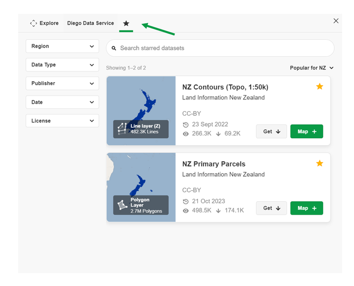
To add or remove a dataset from your Favourite list, click the Star next to it's title on the data card.
Map Viewer / Table Viewer
Map Viewer
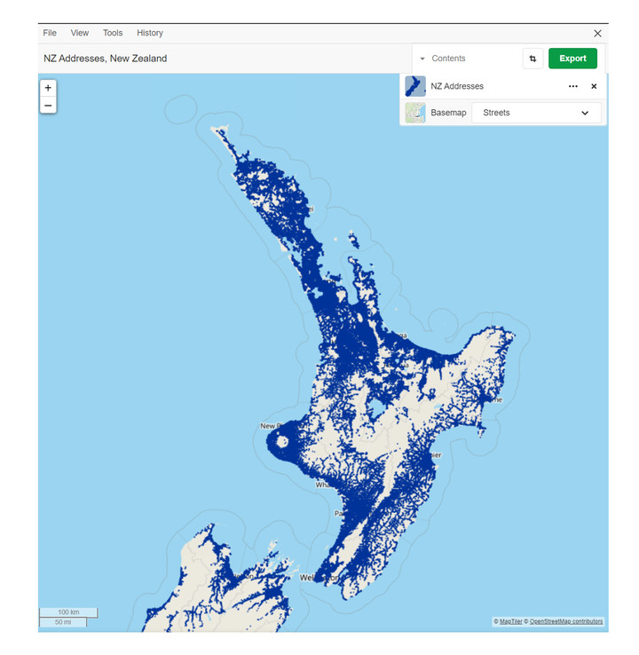
From the Map Viewer, users can display layers from the Data Browser, and interact with the data.
The + and - buttons allow you to zoom in or out gradually
The Map Viewer Menu allows users to create copies, reset the Zoom to include all of the map’s data, and open the Spatial Query tool.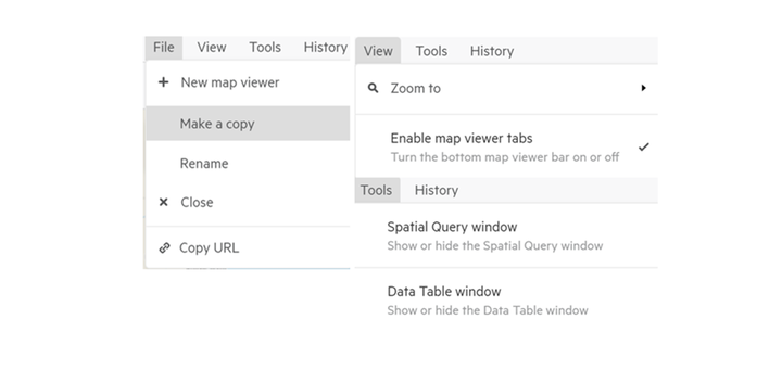
Interact with the map layers selected including the transparency (visibility), open the data table, and alter the base map.

Users can have multiple active Map Viewer windows, and can use the Map Viewer bar to toggle between them.

Table Viewer
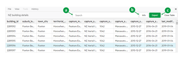
When viewing a non-spatial table, the Table Viewer will display, allowing you to interact with the data.
a) Search for data within the table.
b) Open the table's Data Sheet for more information about the data.
More information: