
Understanding the files in your PDF download
Section titled “Understanding the files in your PDF download”Your PDF download will come in a ZIP that contains a range of files, including:
- The .pdf file
- .xml metadata file for each data layer
- .txt ‘About’ file for each data layer, which includes general information, layer history and licensing information.
What will my PDF look like?
Section titled “What will my PDF look like?”Your PDF will look something like this:
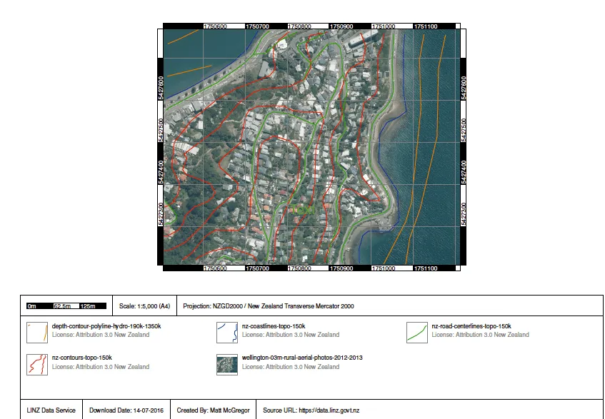
This includes:
- your data layers
- the legend
- a coordinate grid, if you choose to include one.
PDF options
Section titled “PDF options”When you export to PDF, you can choose:
- the page size (A4 by default)
- the orientation (landscape by default)
- Include coordinate grid overlay, which adds a coordinate grid to the map. It’s off by default.
Depending on your software, you should be able to switch these features on and off, including each individual data layer.
Common uses for PDF downloads
Section titled “Common uses for PDF downloads”There are two commons uses for PDF downloads of data from a Koordinates-powered site.
First, users can download a high-resolution version of the data they see on their screen, to print or share.
Second, users can easily import data into non-GIS applications. While Koordinates has supported common GIS formats for many years, PDF export enables non-GIS professionals—such as architects and designers—to use authoritative data in their own software.
Why is my PDF export so large?
Section titled “Why is my PDF export so large?”A PDF export from Koordinates is not a screenshot: It contains all the underlying data of the layers you have added to your map, at the original resolution. This is why, depending on the data you are interested in exporting, your download may be much larger than you expect.
The data on my map looks tiny. What happened?
Section titled “The data on my map looks tiny. What happened?”If you try to add two small layers that are far apart—for example, aerial photography from both Christchurch and Auckland—then the final PDF will appear as two very small points. This is because the extent of the PDF will cover the distance between your chosen data.
Why does my PDF look different than the data I see on my screen?
Section titled “Why does my PDF look different than the data I see on my screen?”The PDF will only contain data that you have permission to download. If you do not have permission to download a data layer, then this will be automatically removed from your download. This may mean that the final output looks different than the data previewed in your browser. If this is the case, you will receive a notification in the download screen.
Size limits for PDF downloads
Section titled “Size limits for PDF downloads”The vector data in a PDF export is limited to 50 MB, because larger files tend to crash common software applications. A PDF export can also include at most 500 raster tiles, so for large raster datasets, crop your export to a smaller area.