Customising Export files
Koordinates provides the ability to customise several data types to suit different needs.
- Raster data resolution
- Include .TAB file for raster data use in MapInfo
- Include or exclude geometry details in Vector data exported as a CSV
- Rename the export zip file
From the Export page, the dataset details appear on the left hand-side of the window.
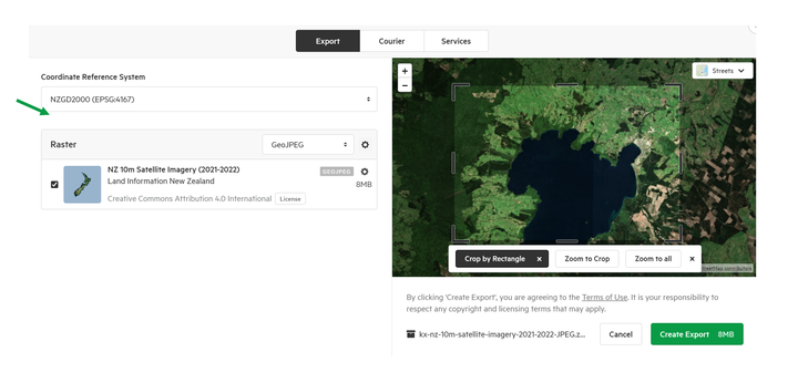
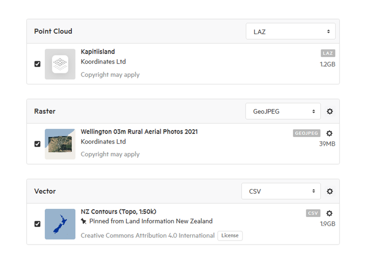
All data is sorted by different file types, to allow for easy identification and to configure specific data types.
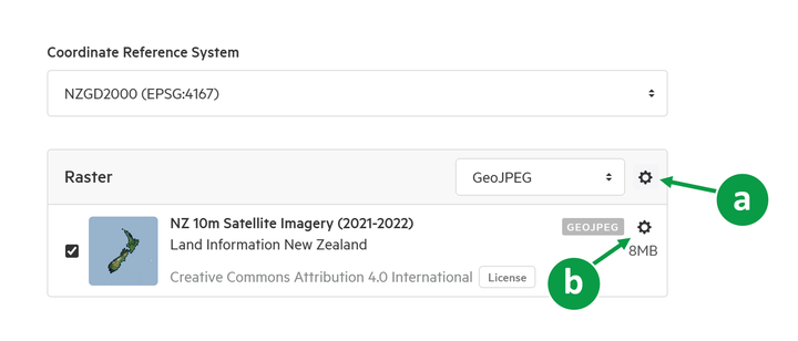
Customise Raster data
There are 2 cogs available to select.
a) global settings - applies to all data of this type in the export
b) dataset specific settings - applies only to that dataset
Two options for raster will be available:
- Downscale the resolution
- Include a .TAB file for use with MapInfo
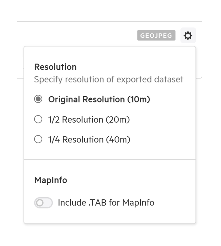
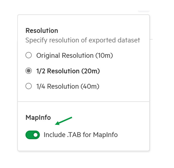
Set raster dataset resolution
1. Select the resolution
The resolution can be set to
- Original resolution
- 1/2 resolution
- 1/4 resolution
The specific resolution will be advised in the bracket.
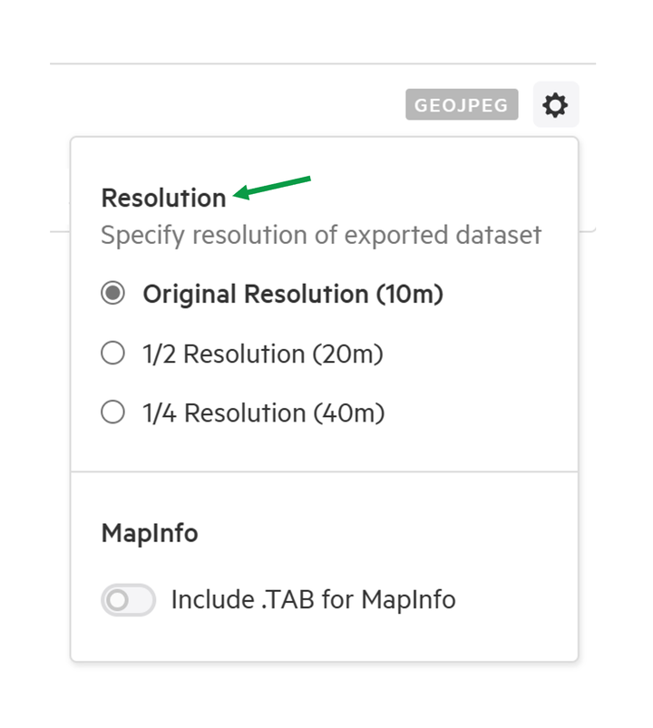
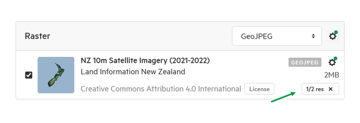
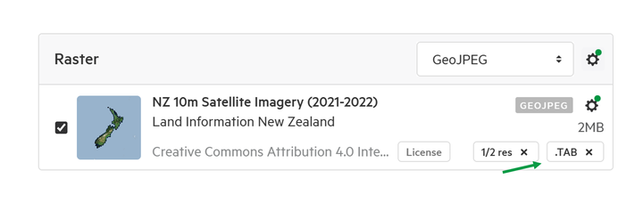
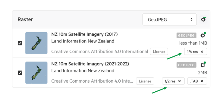
2. The changes are applied
Once a change is applied, a label with the resolution type will appear on the bottom right of the dataset, and the configuration cog will have a green notification dot.
Add .TAB for MapInfo
A .TAB file format enables more convenient use of a raster file in MapInfo.
1. Open the configuration cog
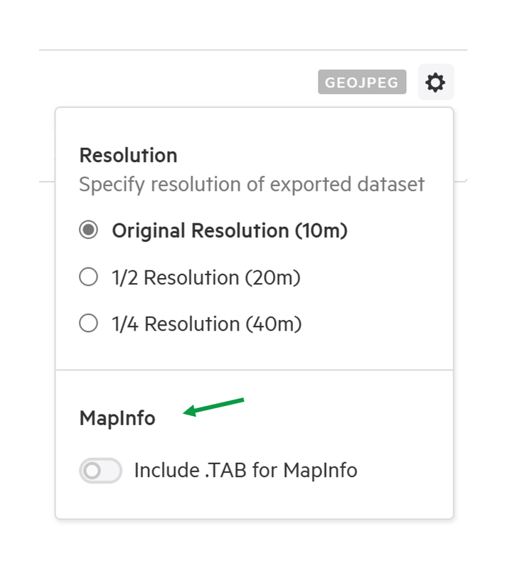
2. Enable 'Include .TAB for MapInfo'
Once a change is applied, a label with '.TAB' will appear on the bottom right of the dataset, and the configuration cog will have a green notification dot.
Multiple Raster files
If there are multiple raster datasets to be exported, it is possible to apply settings globally, or individually.
1. Select the global settings cog to apply to all data of this type in the export
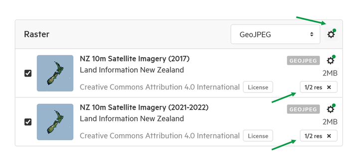
2. Use the unique dataset configuration cog to apply changes to this dataset only
It is possible to have different settings for the datasets in the same export.
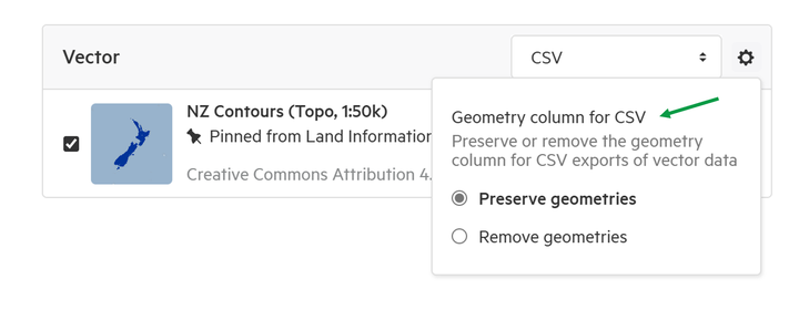
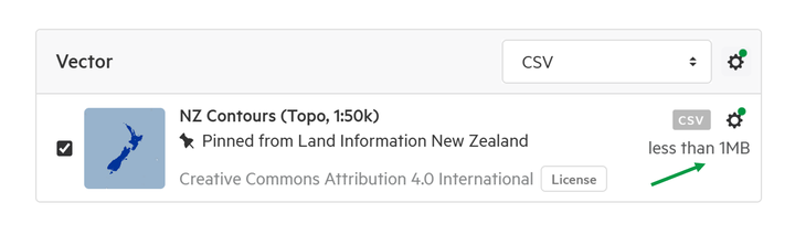
Exclude geometry column of CSV files
For Vector datasets that are being exported as CSV, it is possible to preserve or remove the geometry column. This simplifies that data that is being exported.
1. Select the configuration cog
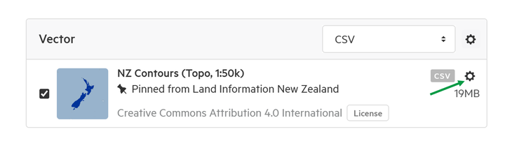
2. Choose to preserve or remove the geometry column
If the geometry column is removed, the size of the file will be reduced.
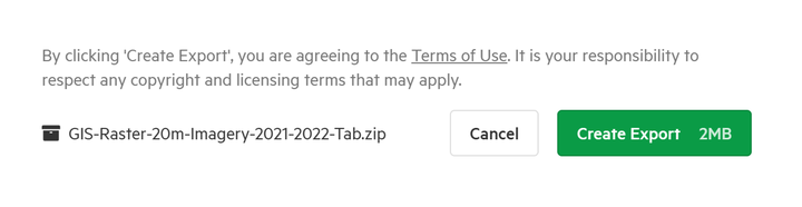
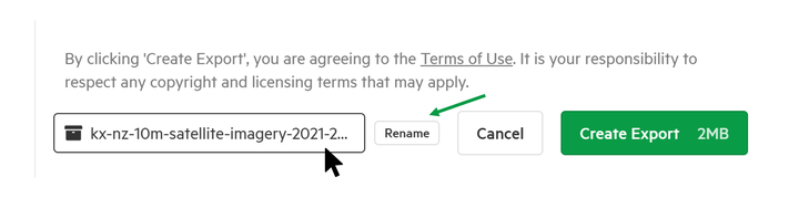
Rename Export zip file
Export .zips can have their filename changed before being exported.
The current name of the file is located underneath the crop map on the Export window.
1. Hover the mouse over the current file name.
A rename button will appear on the right hand-side of the filename.
2. Select Rename
3. Type out the new filename and press Enter to save
Be sure to comply with standard file naming conventions, as incompatible characters aren't supported.