Request data via Courier
Koordinates offers the option to have selected data delivered to you by courier. The minimum size required to create a courier export package is 50GB.
Depending on the total size of the data, we will provide it on a disk drive of suitable capacity, up to 4TB.
1. Find and add the required data to the Map Viewer.

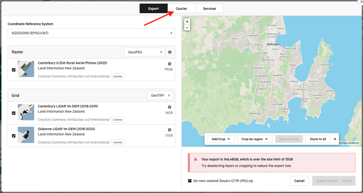
2. Select Export

3. Select Courier

This will take you to the Courier menu.
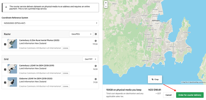
4. Select the relevant Coordinate Reference System that will be used.

5. Select the file type that will be used for the export

Optional
You have the option to alter the area of the data to be used with the export.
- Crop by Map Viewer
- Zoom to Crop
- Zoom to all

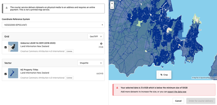
Note: There is a 50GB minimum requirement to utilise the courier service.
If the data cropped fails to meet this threshold, a warning message will appear, and the layer that falls outside of the crop will be labelled.

6. Select Order for courier delivery

This will take you to the final step for ordering a courier delivery.

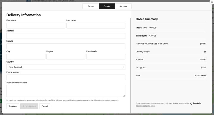
Delivery Information
Complete the required delivery information as well as any additional instructions to assist with the delivery.
Note: All fields are mandatory.
For countries with states, please use the Region field.
Order Summary
The order summary provides the expected billing cost for courier, including delivery fee and relevant taxes.
Please note this price displayed is in NZD, and depending on exchange rates the final price may differ from what you are charged.
7. Select Go to payment
Once all the required fields are completed, proceed to payment

8. Complete payment details
Payment is required by credit card. Once complete submit by clicking Place Order.

This request is sent to Koordinates to process, and you will be updated on expected delivery period, depending on the complexity of the request.
To keep track of your order, navigate to koordinates.com/my/courier-orders/

More information
For more information regarding making payments, and Koordinates Refund and Replacement policy.