Get Started
Account and Support
File Formats and Data Types
Find and Export Data
Esri REST Services, Query API and Web Services
Import Data
Manage Your Site
Plugins
Publish Data
Add cartographic styles to data using CartoCSS
Add layers or tables to an existing set
Add or Edit categories for your site
Add or Edit categories for your site
Add XML metadata from connected sources
Add XML metadata via manual upload
Add XML metadata via the Source Browser
Change the default setting for metadata on your site
Create a Map Viewer
Create a set of multiple data items
Create and edit a catalogue entry
Dual publish data to your portal and Koordinates.com
Edit descriptive information of a layer
Edit details for an existing set
Naming your data
Search Engine Optimisation of your data
Understanding licensing
Understanding metadata
What can I license (and not license) on my site?
Manage service permissions
Site Admin APIs
Update Data
Users and Groups
Desktop App
Frequently Asked Questions
- Home
- Publish Data
- Add layers or tables to an existing set
Add layers or tables to an existing set
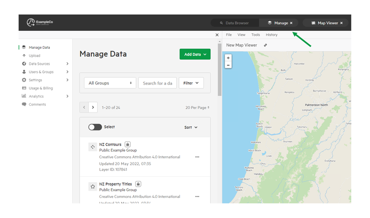
1. Select 'Manage' from the top menu

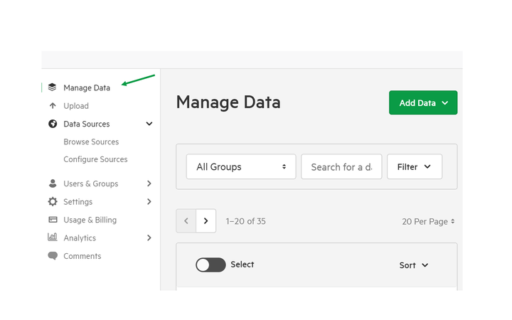
2. Select 'Manage Data'

3. Select your chosen set
This will be the set to which you wish to add additional data layers and tables.

4. Select the 'Content' tab.

5. Select 'Add Dataset +'

6. Search for and select the layer or table to be added.

7. Click 'Save Draft' or 'Publish' to save changes
