Manage service permissions
Service Permissions are available to Enterprise Cloud Plan customers. Contact your Koordinates account manager to discuss enabling service permission management for your site.
This feature is active development. Editable service permissions in the UI in March 2025.
Data that is imported to your Koordinates platform is used to power a range of services, from WFS APIs, tile services, exports and Kart access. Service Permissions provide data administrators with tools to manage access to specific services within their platform.
To view and manage services for a layer, visit the Services tab in the layer's management area. From here you can see a list of all available services for the dataset.
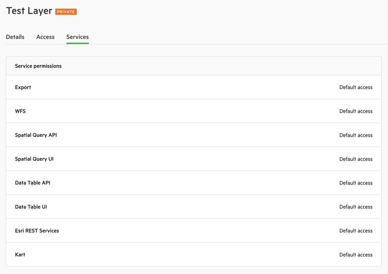
By default, most services will be enabled according to site policies, and permissions for individual services are determined by the permissions that a user has on the owning dataset. For example, a user who has permission to view this layer will be able to use the Spatial Query UI.
Disabled Services
Services that have been disabled for a dataset will be listed with "No Access":
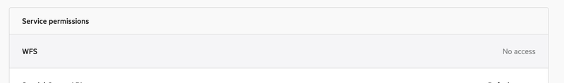
In this scenario, the service will be completely unavailable to all users, including site and data administrators.
Group Permissions
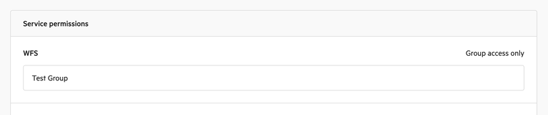
Permissions for individual sevices can be limited to specific groups. If a service has one or more group permission listed, this will displayed under the service with the note "Group access only".
It is important to note that a Group permission will further limit access to the service based on the data permissions. In this example, users of "Test Group" will be able to access the data so long as this group also has access to the data via a download permission.
Other users with download permissions will not be able to access the WFS service, with the exception of Site and Data Administrators of the layer, who will always have access to enabled services.
Service Information
The following is a non-exhaustive list of services that might be listed in the Services area:
- Spatial Query UI – permits users who are exploring data within your site to perform spatial query popups when clicking the map
- Spatial Query API – allows users to use the spatial query API outside of your site to built integrations and apps. See Vector query and Raster query.
- Data Table UI – enables or disables the Data Table component and data sample preview within the site data browser. If disabled, users will not be able to view and search within the layer data table within the site.
- Data Table API – provides API services to list and query layer data outside of the site.
- Export – allows users to export data either within the site or via Export API
- WFS – controls access to OGC Web Feature Services
- Esri REST Services – controls access to Esri REST FeatureServer APIs, if enabled for your site
Developer Information
API documentation is available at https://apidocs.koordinates.com/#tag/Services