Configuring custom basemaps and terrain for map viewers
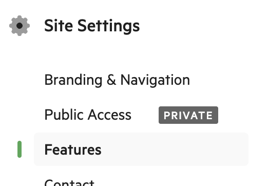
Basemap and terrain settings for map viewers can be found under Site Settings -> Features -> Map viewer settings.
Custom basemaps
Koordinates supports custom basemaps of two types:
- Vector basemaps via a style.json
- Rasterised tile basemaps of either PNG of WebP format via X/Y/Z URLs in the form tiles.example.com/{z}/{x}/{y}.webp or tiles.example.com/{z}/{x}/{y}.png
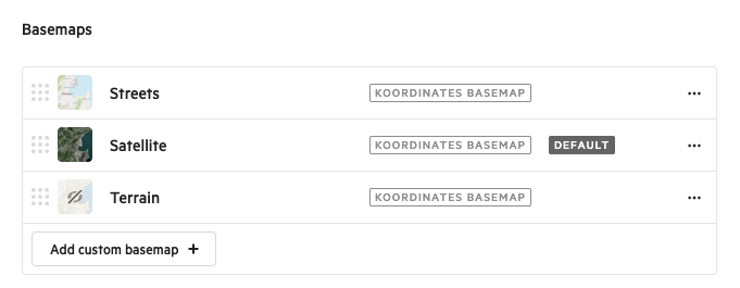
- On the Site Settings -> Features page, find the Basemaps section and click "Add custom basemap".
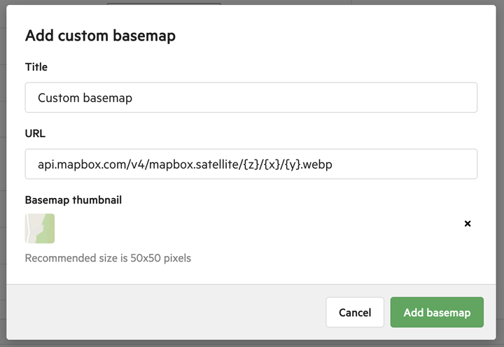
2. Add a title, URL, and thumbnail (required).
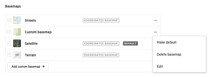
3. Your new custom basemap appears in the basemap list. You can re-order it, make it the default, delete it, or edit its settings.
All visible basemaps are available in the basemap picker under the Contents widget in the map viewer.
Custom terrain services
Koordinates supports terrain services in PNG or WebP format with Mapbox encoding, commonly referred to as Terrain RGB.
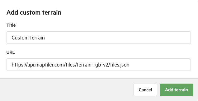
Add a custom terrain by clicking + and providing a title and URL to the service.
The service URL can be of two schemas:
- TileJSON URLs (recommended) - contains metadata such as terrain extent and maximum zoom levels
- X/Y/Z URLs - direct tile URLs in the form tiles.example.com/{z}/{x}/{y}.webp or tiles.example.com/{z}/{x}/{y}.png
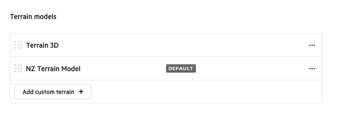
- On the Site Settings -> Features page, find the Terrain Models section and click "Add custom terrain".
2. Inset the URL and give the custom terrain a title
3. Your custom terrain model appears in the list. You can re-order it, make it the default, or delete it.
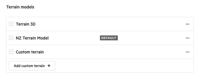
Custom terrain services are listed at the bottom of the basemap picker in the Contents of each map viewer, with the default terrain service used in new map viewers created in the site.
Koordinates provides a default global terrain service for use when no custom terrain services are configured.