Manage Site Services & APIs
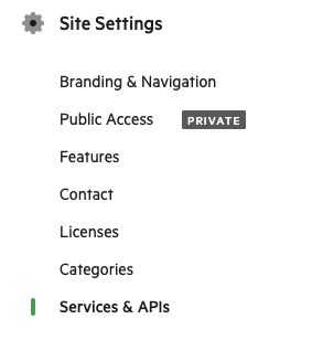
Site Administrators can modify the availability of services and API's for an entire site. Find the Services & API's area under Site Settings.
Service Settings
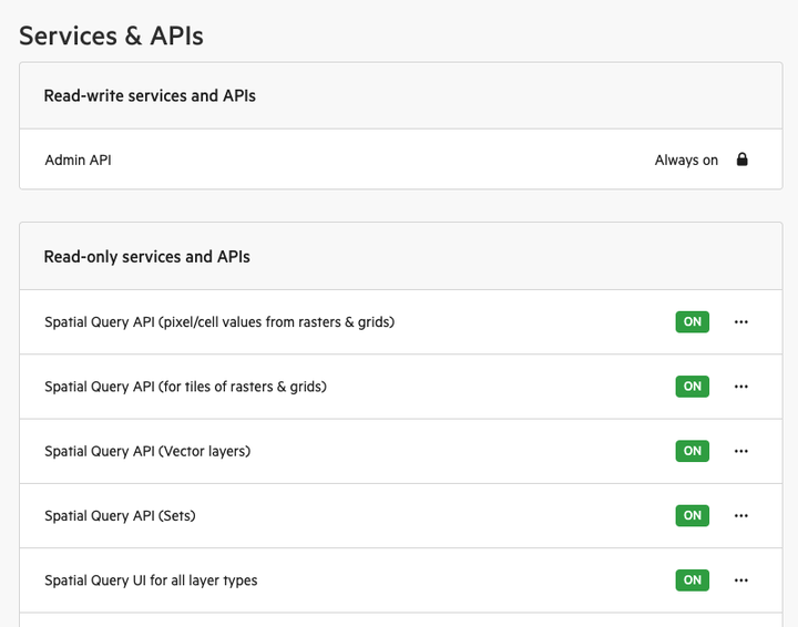
Read-write APIs and Services that are those capable of data writes. Read-only are only able to read the data without modifying it.
If a service is set to Off, it cannot be used site-wide. If a service is set to On, the service is enabled site-wide by default. Changes make take several minutes to take effect.
Types of Services
Some services and API's may be unavailable on your subscription plan. Please contact Koordinates sales to enquire.
- Admin API - General platform API for Koordinates. Always on.
- Spatial Query API (pixel/cell values from rasters & grids) - Retrieves intersecting pixel/cell values from raster/grid layers at an X,Y point
- Spatial Query API (for tiles of rasters & grids) - Queries information about tiles (e.g., IDs, bounds) at a given point for rasters/grids
- Spatial Query API (vector layers) - Queries vector layers at an X,Y point + radius for intersecting features.
- Spatial Query API (sets) - Queries a set of layers at an X,Y point + radius to identify intersecting features.
- Spatial Query UI for all layer types - enable or disable the spatial query results widget from map viewers across your entire site.
- Data Table API - Retrieve 'attribute' tables from vector layers.
- Data Table UI for all layer types - enable or disable the data table widge from map viewers across your entire site.
- WFS - OGC Web Feature Service (WFS) allows for requesting and retrieving vector features from vector layers
- WFS Changesets - Retrieve changesets between different dataset revisions using WFS with custom parameters.
- Esri REST Services - Esri-compatible REST endpoints for querying and retrieving vector layers.
- 3D Tiles Service - endpoint for retrieving 3D Tiles
- Point cloud (COPC) viewing available in map viewer - showing COPC Point clouds within map viewers across your site
- Point cloud (COPC) Services - COPC Point cloud API endpoints
Service Access
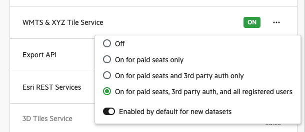
Depending on the service and your site plan, service access can be configured to the one of the following states:
- Off - No one can use the service
- On for paid seats only - Paid seats can use the service
- On for paid seats and 3rd party auth only - Paid seats and any users authenticated via third party authentication can use the service
- On for paid seats, 3rd party auth only, and all registered users - As above, but all users registered on the site can use the service
- On for paid seats, 3rd party auth only, and all users - As above, unregistered users can use the service too.
Dataset-level service permissions
The site-level service permissions configure broad user-type based access to services. Some plans allow setting additional fine grained permissions at the service level, or whether those services are enabled.
For some plans, "Enabled by default for all new datasets" is an additional option. If this is off, all future datasets will have this service disabled by default. These services can then be re-enabled on a dataset-by-dataset basis via the API, as described here: https://apidocs.koordinates.com/#tag/Services
It is also possible to finely configure permissions to a service on a particular dataset. For example, you might want to allow only paid seats to use the WMTS services across the site, so you configure site-level setting to "On for paid seats only". You can then restrain download permissions on a particular layer, and then again restrain which users can access the WMTS service for that dataset. These dataset-level service permissions can be configured directly via the API, as described here: https://apidocs.koordinates.com/#tag/Services