
Find & export data
This guide shows you how to find and export data from a site on the Koordinates platform. To export several layers at once, see Find and export multiple data layers.
It’s intended for first-time users. For more detail, read the rest of the Get Started guides, or see Find and export data.
To export data, you need to be signed in with a Koordinates ID.
1. Enter your search term
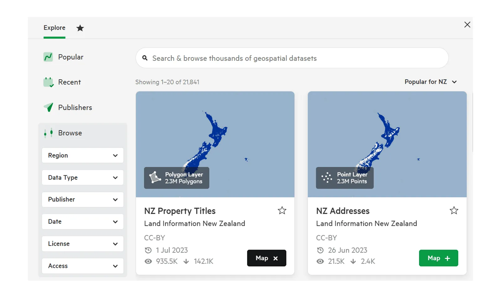
Section titled “1. Enter your search term”Enter a term in the search bar at the top of the data browser.
2. Filter your results
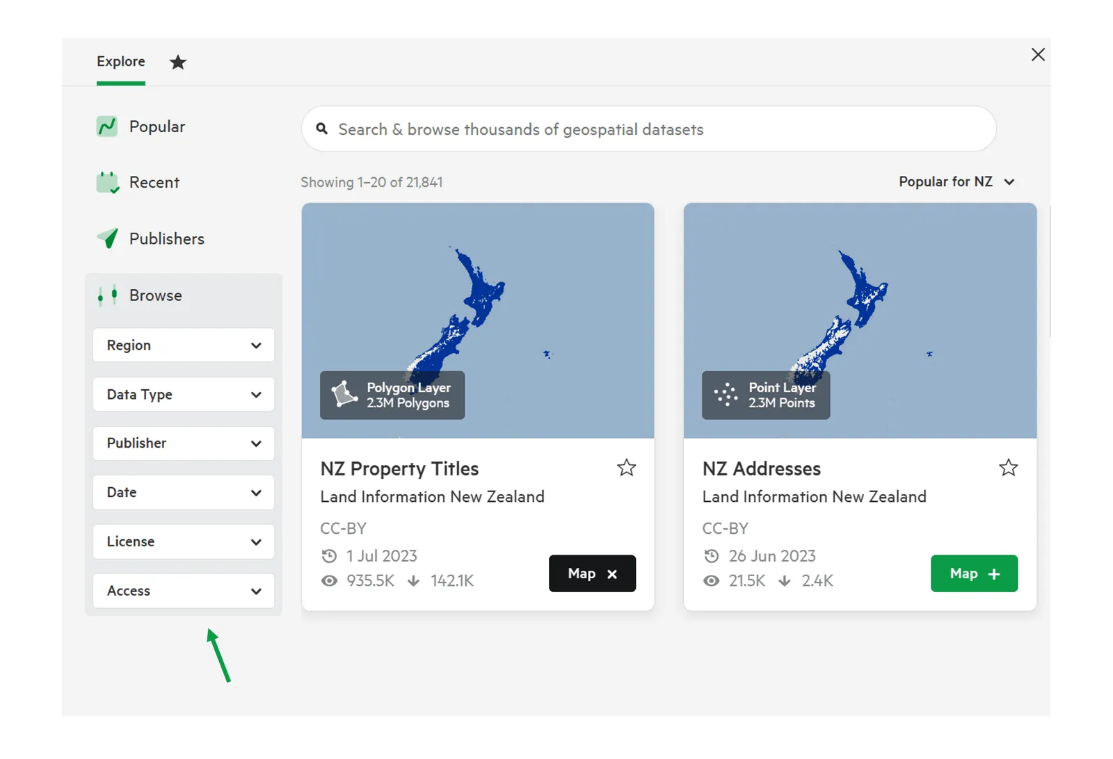
Section titled “2. Filter your results”Use the filters to narrow your results. Depending on the site, these include:
- Region
- Data Type
- Publisher
- Date
- License
- Access
3. Add your data to the map
Section titled “3. Add your data to the map”Select Map on the card for the data you want. It’s added to the map viewer. You can add several layers.
4. Select ‘Export’
Section titled “4. Select ‘Export’”In the map viewer, select Export to start exporting the data on the map.
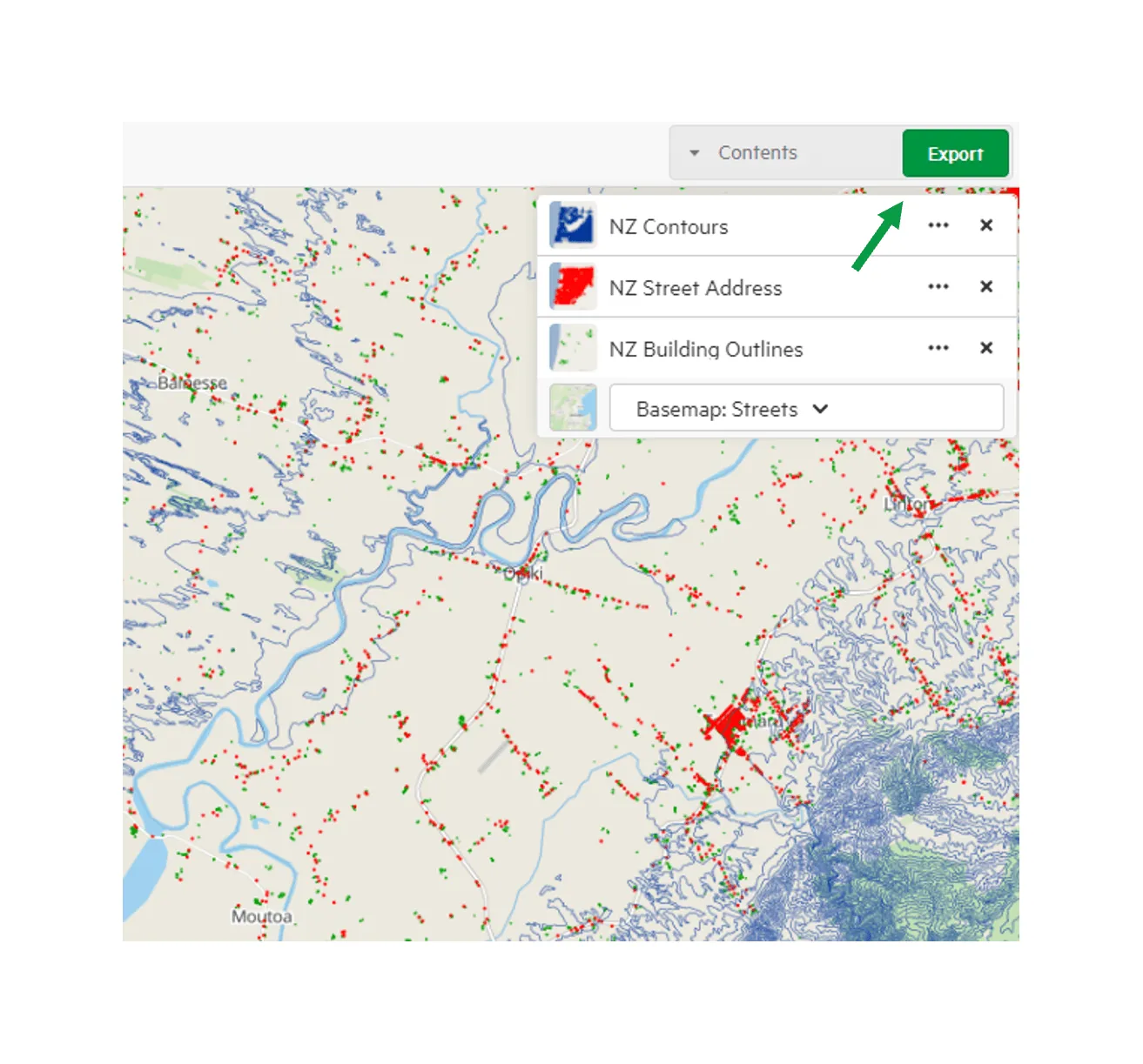
You can also export a single dataset from its sheet: open the … menu and select Export.
5. Choose your export options
Section titled “5. Choose your export options”In the export window, you can:
- choose a file format for each type of data;
- choose a Coordinate Reference System;
- crop the data to reduce the file size: select Add Crop, then Crop by Rectangle, Crop by Map Viewer extent or, where available, Crop by region; and
- rename the download file.
Then select Create Export.
When your export is ready, you can download it from the export progress panel in the top navigation, or from Exports in your user menu.
For more on the export options, see The export page.