
Connect to a WFS service
WFS, or Web Feature Services, is an OGC standard web service for geospatial data. With a query endpoint, Koordinates is able to scan and add data from public WFS services. We are also able to add data from WFS services that have a username and password.
Connect to a WFS service
Section titled “Connect to a WFS service”1. Select ‘Manage’ from the top navigation menu
Section titled “1. Select ‘Manage’ from the top navigation menu”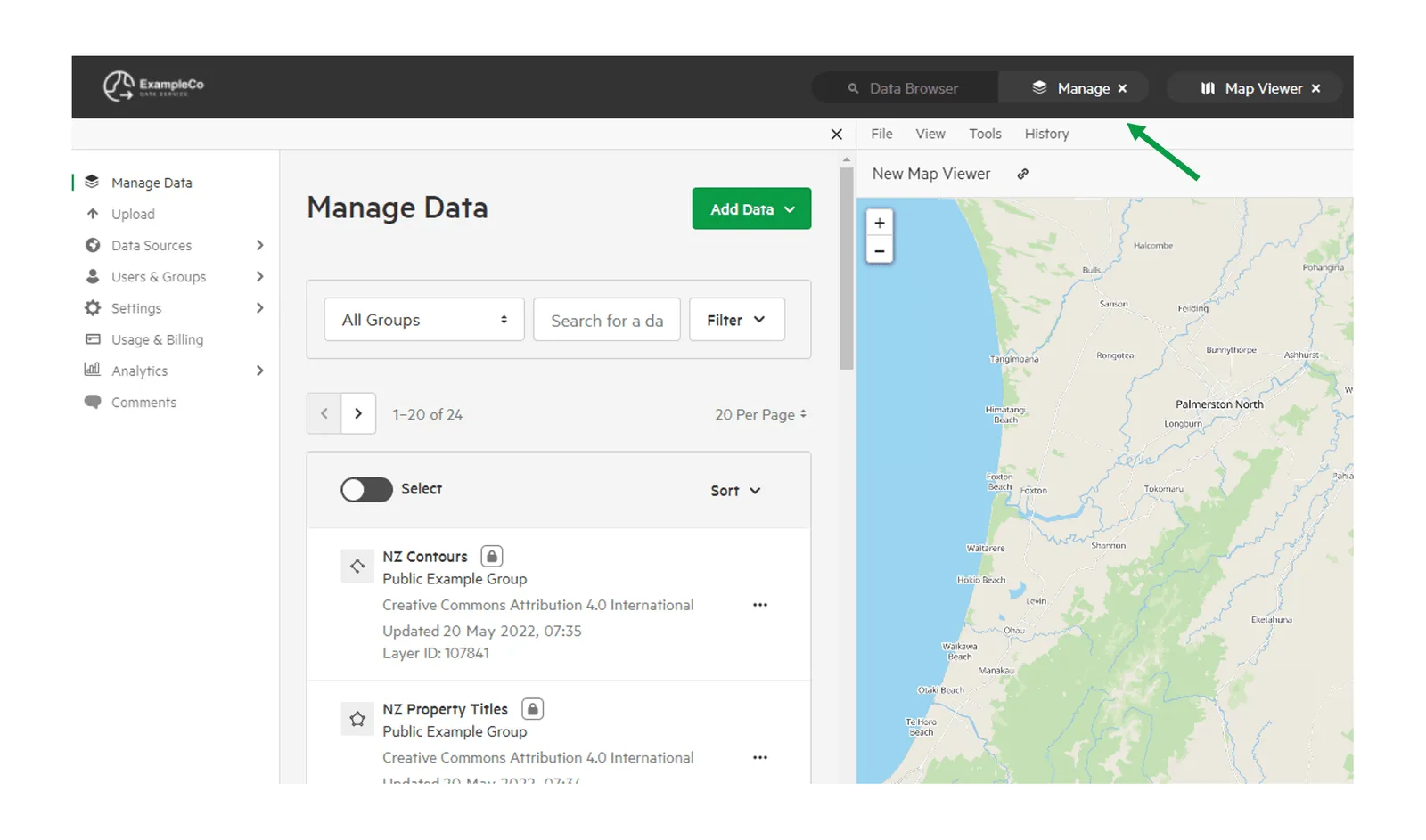
2. Click ‘Data Sources’ and select ‘Configure Sources’
Section titled “2. Click ‘Data Sources’ and select ‘Configure Sources’”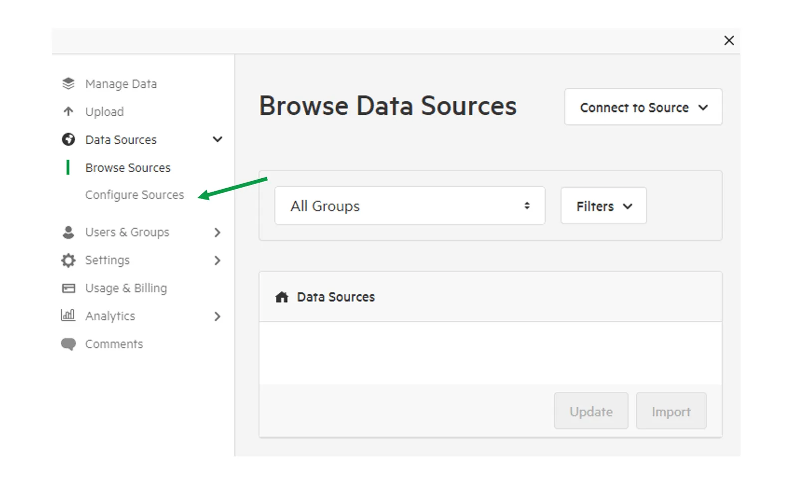
3. Click ‘Add a Source’ and select ‘WFS’
Section titled “3. Click ‘Add a Source’ and select ‘WFS’”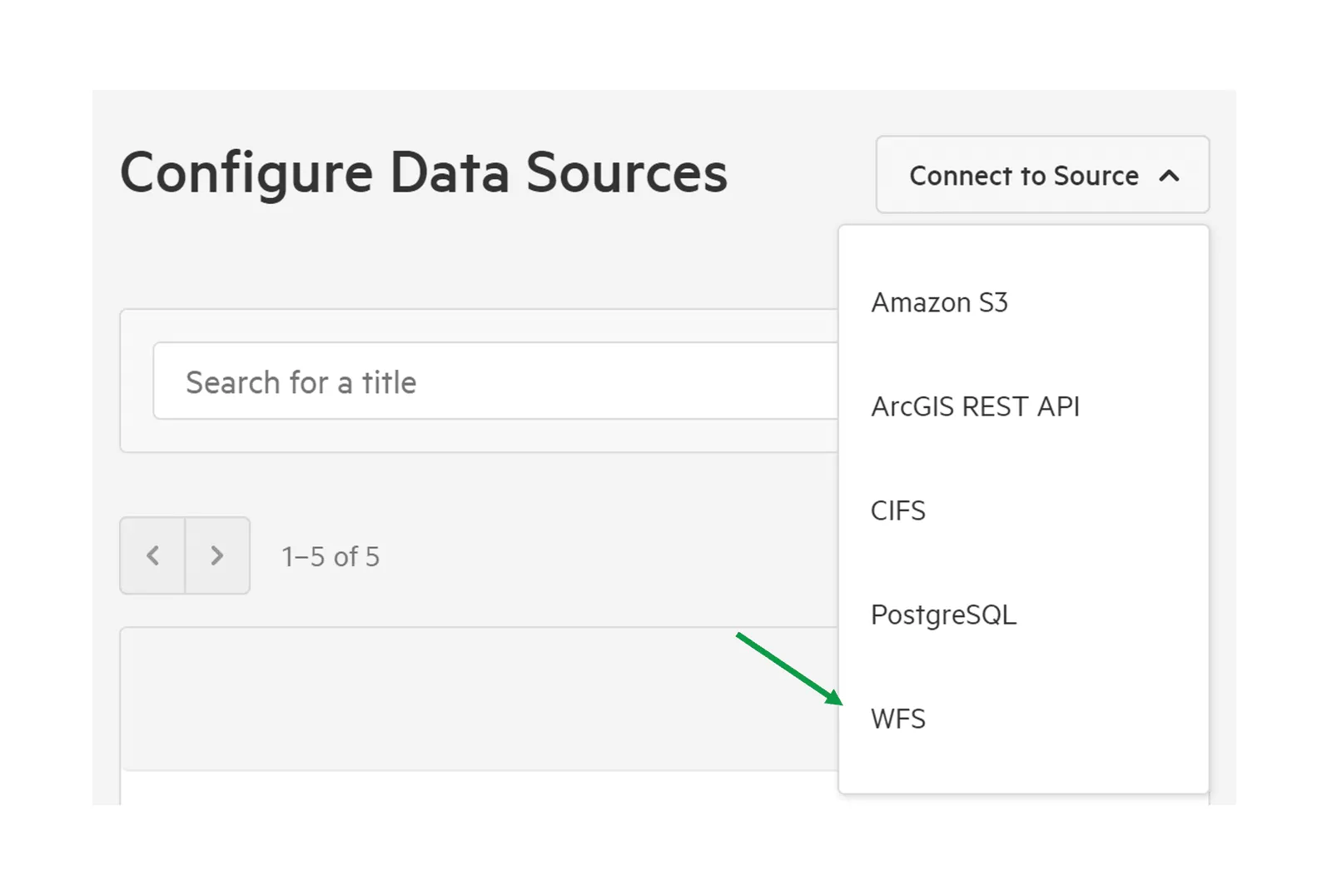
4. Add Remote URL and authentication details (if required)
Section titled “4. Add Remote URL and authentication details (if required)”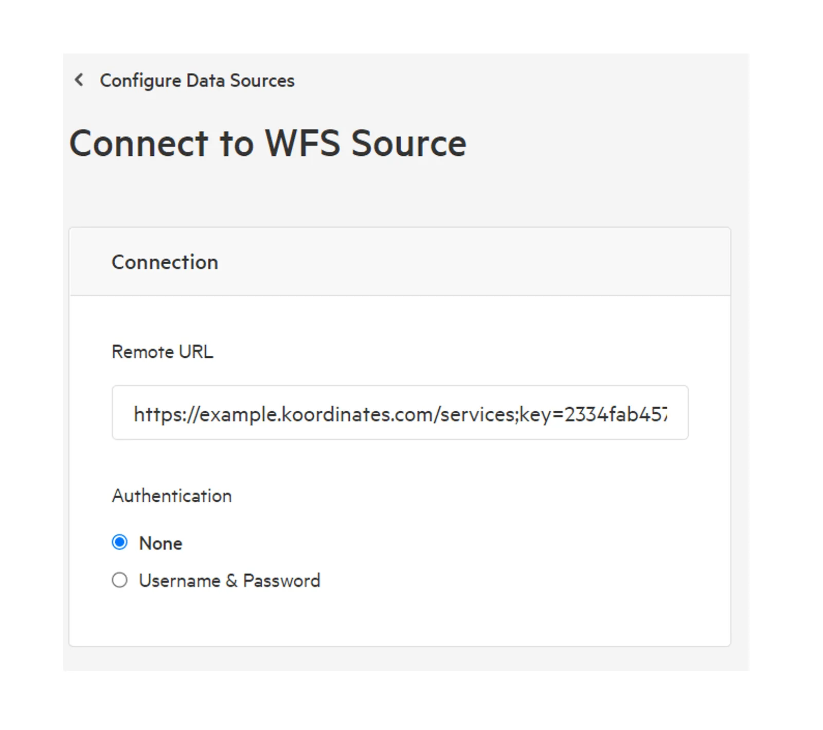
5. Give your source a meaningful title and choose an Owning Group. Click Connect.
Section titled “5. Give your source a meaningful title and choose an Owning Group. Click Connect.”Owning Groups are used to categorise and manage permissions on data. Don’t worry if you’re not sure—you’ll be able to change the Owning Group before importing any data into your data service.
If correctly configured, Koordinates will immediately connect and scan your data source.
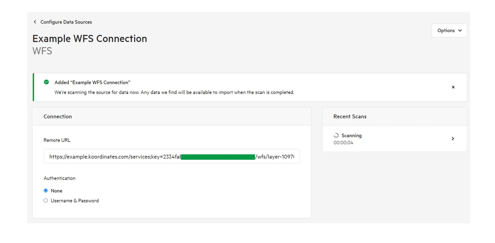
Manage your WFS source
Section titled “Manage your WFS source”1. Click ‘Data Sources’ and select ‘Configure Sources’
Section titled “1. Click ‘Data Sources’ and select ‘Configure Sources’”
2. Select your source
Section titled “2. Select your source”To locate your source, browse the source list, filter by type or add a keyword into the search bar.
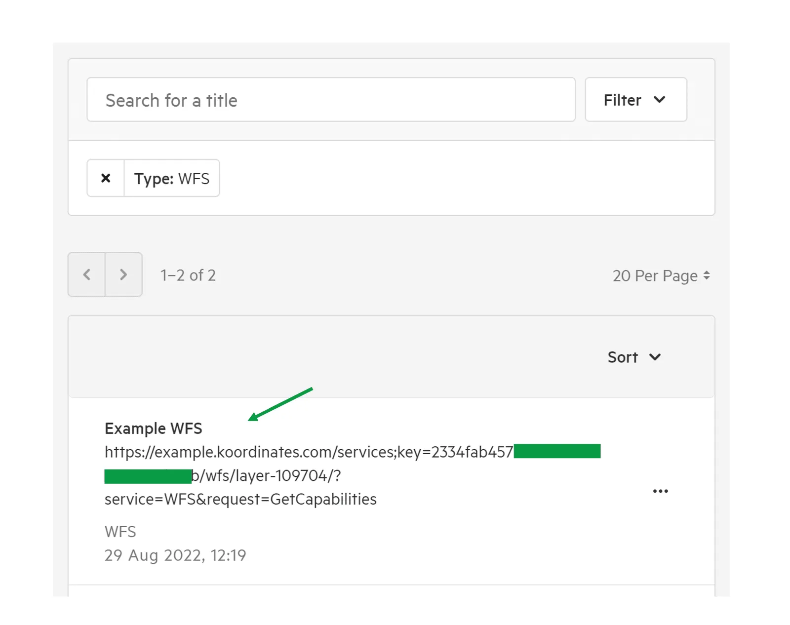
3. Edit Connection details for your source
Section titled “3. Edit Connection details for your source”